Livermore’s Trusted Land Surveying Experts – Our Services & Benefits
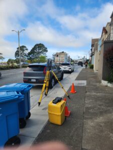
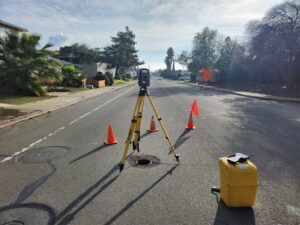
 At Transit Land Surveying, Inc., we provide accurate and Professional Land Surveying services for homeowners, businesses, and developers in Livermore, CA. Whether you need to confirm property boundaries, prepare for construction, or complete a commercial real estate transaction, having precise land data is essential. Our experienced team uses advanced equipment and proven methods to deliver detailed reports that support a wide range of projects. This is an overview of our surveying services and how they benefit Livermore property owners.
Why Choose Transit Land Surveying, Inc. in Livermore?
Choosing a reliable land surveyor is important for property owners, contractors, and developers. A Professional Survey provides legal clarity, supports smooth construction planning, and helps resolve property line concerns.
Our team has extensive experience in Livermore and the surrounding areas. We understand local land conditions, zoning regulations, and city requirements. We work closely with homeowners, builders, real estate professionals, and businesses to deliver accurate, legally recognized survey data for a variety of projects.
Key Land Surveying Services We Offer
Our Land Surveying services help property owners manage real estate transactions, development projects, and construction planning.
Boundary Surveys
A boundary survey confirms property limits and provides documented proof of land ownership. This survey is essential before buying or selling land, installing fences, or resolving property disputes. Title companies, homebuyers, and real estate professionals rely on boundary surveys to confirm that legal descriptions match actual property lines.
Topographic Surveys
A topographic survey maps natural and man-made features on a property, including elevation changes, drainage patterns, and existing structures. Engineers and architects use this data to design buildings, roads, and infrastructure that fit the landscape. Developers also need topographic surveys when planning grading, drainage improvements, and utility placement.
Construction Staking
Construction staking marks the exact locations for buildings, roads, and underground utilities. Surveyors place stakes at key points based on approved site plans, helping contractors position structures correctly. This service reduces the risk of errors and helps keep projects on schedule.
ALTA/NSPS Surveys
Commercial real estate transactions require detailed property reports. An ALTA/NSPS survey provides a complete overview of property boundaries, easements, zoning restrictions, and site improvements. Lenders, investors, and title companies use these surveys to confirm land use compliance before finalizing property sales.
Specialized Surveys for Flood Risk & Water Management
Some areas in Livermore are prone to flood risks or water-related development challenges. These specialized surveys provide important data for insurance, construction, and environmental planning.
FEMA Elevation Certificates
For properties located in flood zones, a FEMA elevation certificate measures a structure’s elevation in relation to FEMA’s base flood elevation (BFE). This certificate helps homeowners determine flood insurance rates and can be used to request a Letter of Map Amendment (LOMA) if the property qualifies for a zoning adjustment.
Hydrographic Surveys
For properties near water sources, hydrographic surveys provide data on shorelines, drainage systems, and underwater terrain. These surveys assist with stormwater management, erosion control, and waterfront construction projects. Environmental planners and developers rely on this information to improve drainage solutions and prevent future water damage.
Monitoring Surveys
 Soil movement, nearby construction, and environmental changes can cause gradual shifts in land or buildings. Monitoring surveys track these changes over time, helping property owners detect potential risks before they cause damage. This service is useful for:
- Homes near excavation sites or large construction projects.
- Older buildings that may experience foundation settling.
- Public infrastructure such as roads, bridges, and retaining walls.
By identifying movement early, property owners can take preventative action to avoid costly structural repairs.
More Services for Property Owners & Developers
In addition to standard property and construction surveys, we provide specialized services to meet unique land development needs.
- Setback Verification Surveys – Confirms that new structures follow local zoning regulations and setback requirements.
- Easements & Legal Descriptions – Documents property access rights for utilities, shared driveways, and land use agreements.
- Monument Preservation – Maintains and restores survey markers that define property boundaries.
If your project requires a survey not listed here, we offer customized options to address specific land-use concerns.
Get Started with Professional Surveying Today
If you need land surveying services in Livermore, CA, Transit Land Surveying, Inc. is ready to assist. We provide accurate, legally recognized survey data for homeowners, businesses, and developers.
Contact us today for a free consultation and expert guidance on your surveying needs. Whether you are planning construction, buying property, or managing land use, our team is here to help in any way we can.
